
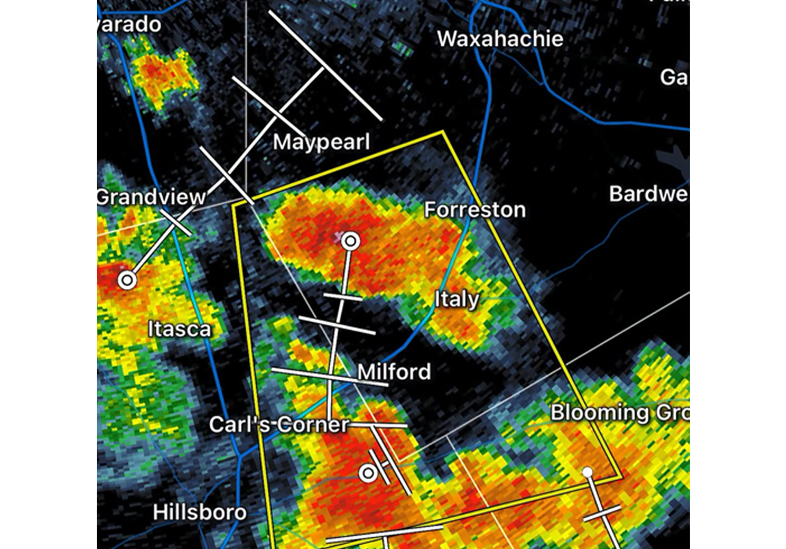
MAYPEARL – A slow-moving severe thunderstorm brought an unexpected hit to northwest Ellis County on Friday evening, Sept, 11, leaving pockets of property damage across Maypearl and putting localized infrastructure to the test.
The National Weather Service Fort Worth bureau issued a targeted Severe Thunderstorm Warning as the cell drifted directly over the area, clocking radar-indicated straight-line wind gusts of 60 m.p.h..
The storm’s unusually sluggish forward pace – crawling southeast at just 5 m.p.h. – subjected residents to a prolonged period of torrential downpours, intense cloud-to-ground lightning, and volatile winds.
While the system triggered immediate anxiety for a community still remembering the destructive winds of March 2025 that heavily damaged the Maypearl Primary School campus, local emergency response officials confirmed Friday’s impact was far less catastrophic.
Ground reports indicated scattered instances of property damage, including compromised residential fencing, torn roof shingles, and minor impact on unsecured outdoor property and RVs.
Pockets of pea to ping-pong-ball-sized hail were also noted, though no widespread automotive losses or structural collapses were reported in downtown Maypearl.
The storm’s primary calling card on the ground was a high volume of scattered debris and downed tree limbs.
Local emergency managers note that this specific type of damage was heavily exacerbated by the county’s ongoing environmental conditions.
When the storm’s 60 m.p.h. straight-line winds slammed into these vulnerable canopies, branches snapped easily under the pressure, scattering heavy debris across residential roadways and power lines.
Fortunately, the intense lightning display accompanying the cell did not ignite any fresh wildfires in the parched terrain, as the accompanying localized downpours helped dampen the immediate fuel sources.
With the storm now gone, Maypearl residents are back to dealing with the extreme summer heat as a Heat Advisory remains in effect for the area.